What ground sample distance do you need to rank a portfolio without a walk-down?
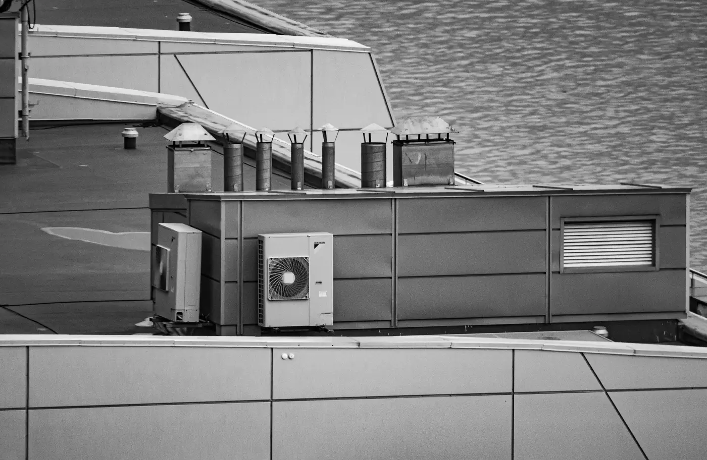
If you've tried to screen a multi-site portfolio off standard satellite imagery, you've probably hit the same wall: the roof shows up fine, but the rooftop doesn't tell you anything useful. You can see there's a building. You can't see the HVAC cluster sitting where you'd want to run a string, or the skylight band cutting your southern exposure in half.
That's a ground sample distance problem, and it's worth being specific about what GSD you need before you spend a desk-screen cycle on imagery that can't answer the question.
What GSD means for a rooftop, not a field
Ground sample distance is just the size of ground that one pixel covers. A 1 m GSD image gives you a pixel for every square meter, fine for spotting a building footprint, hopeless for telling a rooftop unit from a parapet shadow. For agricultural or land-cover work, 1 to 3 m is often plenty. For a rooftop, where the obstructions that eat your usable area are a meter or two across each, that same resolution turns every mechanical unit into a blur you have to guess at.
The practical floor for rooftop work sits well under a meter, finer than 0.5 m. At that resolution, individual HVAC units, vent stacks, skylights and parapet lines start to separate from each other instead of merging into a single gray mass. That's the resolution where a desk reviewer can trace usable roof area with some confidence that what they're excluding is an obstruction, not noise.
Why coarser imagery forces you back to a site visit
A lot of screening workflows skip past what resolution actually determines: whether your first-pass ranking is trustworthy enough to act on. If the imagery can't resolve obstructions, your installable area estimate is really just footprint area with a rough discount applied. That number is close enough to flag a site as "worth a look," but not close enough to rank twenty sites against each other with any confidence, which is the whole point of screening a portfolio before you commit site-visit budget to it.
So teams end up doing what the screen was supposed to replace: sending someone to walk the roof, measure clearances, and sketch obstructions by hand, one site at a time, across however many properties are in the portfolio. That's the workflow a VHR pass is meant to shortcut, not duplicate.
Orientation and shading still need the pixel count
Resolution also matters for the two other inputs that turn raw square meters into installable kWp: orientation and obstruction-driven shading. A ridge line or a roof section's pitch is easier to call correctly when the imagery resolves the roof plane's edges cleanly, rather than interpolating them from a handful of coarse pixels. The same goes for figuring out which obstructions cast a shadow long enough to matter for the array versus which ones are too low-profile to count.
None of this requires sub-centimeter drone-grade resolution, which is overkill for a portfolio screen and not realistic to fly across dozens of sites anyway. It requires imagery fine enough that a single pass, VHR satellite or aerial RGB, can stand in for the obstruction and orientation detail a walk-down would otherwise give you by hand.
Cadence is the other half of the question
Resolution gets a roof screened correctly once. Cadence is what keeps that ranking current as roofs change: a new rooftop unit goes in, a tenant adds equipment, a re-roof shifts the mechanical layout. An annual VHR pass is enough to catch those changes and re-rank the portfolio without repeating a walk-down every time something on a roof moves.
Rooftop Solar Suitability runs that annual pass across a portfolio and hands back installable kWp per site, not raw square meters, which is the number you need before shortlisting sites for PPA bids.
If you're screening a portfolio and want that first pass done without the roof-by-roof visits, get in touch.